Utracono hasło? Nowy użytkownik? Zarejestruj się
Clownfish, Philippines. Photo by Stephane Rochon.
Baw się i pomagaj!
| Znajdź najlepsze miejsce nurkowe |
|
|
 Faroe Islands
Europa
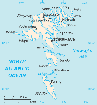
Lokalizacja: Faroe Islands (or Faeroe Islands) Northern Europe, island group between the Norwegian Sea and the North Atlantic Ocean, about half way between Iceland and Norway
Koordynaty geograficzne: 62° 0' N, 7° 0' W
Linia brzegowa: 1,117 km km
Klimat: mild winters, cool summers; usually overcast; foggy, windy
Teren: rugged, rocky, some low peaks; cliffs along most of coast
Najwyższy punkt: lowest point: Atlantic Ocean 0 m
highest point: Slaettaratindur 882 m
Naturalne zagrożenia: NA
Waluta: Danish krone (DKK) ?
Populacja: 48,668 (July 2008 est.)
Języki: Faroese (derived from Old Norse), Danish
Stolica: Torshavn
Podział: part of the Kingdom of Denmark; self-governing overseas administrative division of Denmark
Więcej szczegółów
| Jan | Feb | Mar | Apr | May | Jun | Jul | Aug | Sep | Oct | Nov | Dec | |
|---|---|---|---|---|---|---|---|---|---|---|---|---|
| Climate | ||||||||||||
| Air temp. | ||||||||||||
| Water temp. | ||||||||||||
| Equipment | Keine Ahnung | Keine Ahnung | Keine Ahnung | Keine Ahnung | Keine Ahnung | Keine Ahnung | Keine Ahnung | Keine Ahnung | Keine Ahnung | Keine Ahnung | Keine Ahnung | Keine Ahnung |
| Best season | ||||||||||||
Dodatkowa mapa
Chcesz dodać jakąś informację o Faroe Islands? Znamy....
Ta mapa jest interaktywna! Użyj kontrolek celem przybliżenia i oddalenia.
- dive logs (1)
- podróże (0)
- Zdjecia (0)
- Filmy (0)
- Podziel się
- Ulubione
-
Twoje ulubione i przyszłe miejsca nurkowe
Miejsca nurkowania
| Miejsca nurkowania (2) | Jakość | Średnia głębokość | Maksymalna głębokość | Doświadczenie | Typ nurkowania | ||
|---|---|---|---|---|---|---|---|
| Nolsoe | - / - | 18 m | 25 m | CMAS ** / AOW | 


|
||
| Olavur Gregersen Wreck | - / - | 12.6 m | 28.6 m | CMAS ** / AOW | 

|
 Dive logs
Komentarze
Błąd, powiadom nas o błędzie
Jeśli chcesz dodać nowe informacje lub znalazłeś błędy w opisie tego kraju, Wyślij nam odpowiedź zwrotną.