Utracono hasło? Nowy użytkownik? Zarejestruj się
Whale Shark, Philippines. Photo by Stephane Rochon.
Baw się i pomagaj!
| Znajdź najlepsze miejsce nurkowe |
|
|
 Útila Island
Honduras, Bay Islands
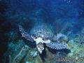
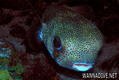
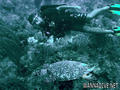
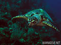
English (Przetłumacz ten tekst w Polski): Útila (Isla de Útila) is the third largest of Honduras' Bay Islands, after Roatán and Guanaja, in a region that marks the south end of the Mesoamerican Barrier Reef System, the second-largest in the world. The eastern end of the island is capped by a thin veneer of basaltic volcanic rocks, erupted from several pyroclastic cones including 74 m (243 ft) Pumpkin Hill which forms the highest point on the island. It has been documented in history since Columbus' fourth voyage, and currently enjoys growing tourism with emphasis on recreational diving.
Więcej szczegółów
| Jan | Feb | Mar | Apr | May | Jun | Jul | Aug | Sep | Oct | Nov | Dec | |
|---|---|---|---|---|---|---|---|---|---|---|---|---|
| Climate | ||||||||||||
| Air temp. | ||||||||||||
| Water temp. | ||||||||||||
| Equipment | Don't know | Don't know | Don't know | Don't know | Don't know | Don't know | Don't know | Don't know | Don't know | Don't know | Don't know | Don't know |
| Best season | ||||||||||||
Ta mapa jest interaktywna! Użyj kontrolek celem przybliżenia i oddalenia.
- dive logs (0)
- podróże (0)
- Zdjecia (9)
- Filmy (0)
- Podziel się
- Ulubione
-
Twoje ulubione i przyszłe miejsca nurkowe
Miejsca nurkowania
| Miejsca nurkowania (21) | Jakość | Średnia głębokość | Maksymalna głębokość | Doświadczenie | Typ nurkowania | ||
|---|---|---|---|---|---|---|---|
| Airport Caves | - / - | 10 m | 18 m | Dla każdego nurka | 
|
||
| Aquarium | - / - | 15.2 m | 18.3 m | CMAS * / OW |
|
||
| Black Corral Wall | - / - | 4.6 m | 39.6 m | Dla każdego nurka | 

|
||
| Black Hills | 3 / - | 12 m | 30 m | Dla każdego nurka | 

|
||
| Blackish Point | - / - | 15 m | 26 m | Dla każdego nurka |
|
||
| CJ's Dropoff | - / - | 15.2 m | 36.6 m | Dla każdego nurka |
|
||
| Duppy Waters | 1 / - | 15 m | 30 m | Dla każdego nurka |
|
||
| Eagle Ray Alley | - / - | 15 m | 24 m | Dla każdego nurka |
|
||
| Great Wall | - / - | 20 m | 29 m | CMAS * / OW |
|
||
| Halliburton | 2 / - | 27 m | 31 m | Dla każdego nurka | 
|
||
| Jack's Bight | - / - | 6.1 m | 19.8 m | CMAS * / OW |
|
||
| Little Bight | - / - | 7 m | 30 m | Dla każdego nurka |
|
||
| moon hole | - / - | 4.6 m | 24.4 m | Dla każdego nurka |
|
||
| Old House | 2 / - | 15 m | 40 m | Dla każdego nurka |
|
||
| Raggedy Cay | - / - | 15 m | 30 m | Dla każdego nurka |
|
||
| Ships Stern | - / - | 15 m | 25 m | Dla każdego nurka | 
|
||
| Silver Garden | - / - | 9.1 m | 36.6 m | Dla każdego nurka |
|
||
| Sting Ray Point | - / - | 15.2 m | 23.2 m | Dla każdego nurka | 
|
||
| Ted's Point West | - / - | 15.2 m | 18 m | Dla każdego nurka |

|
||
| The Maze | - / - | 15 m | 40 m | CMAS * / OW |
|
||
| Utila Open Water | 1 / - | 3 m | 15 m | Dla każdego nurka | 
|
 Komentarze
To będzie pierwszy komentarz o tym kraju
Błąd, powiadom nas o błędzie
możesz skorygować te błędy lub dodać informacje. Jeśli masz problemy odwiedź ta stronę, Wyślij nam odpowiedź zwrotną.