Utracono hasło? Nowy użytkownik? Zarejestruj się
Lizard fish, Philippines. Photo by Stephane Rochon.
Baw się i pomagaj!
| Znajdź najlepsze miejsce nurkowe |
|
|
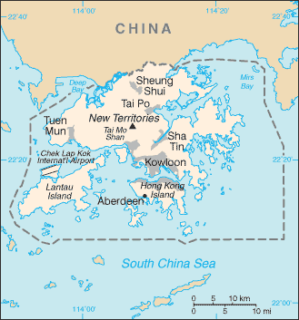
 Hong Kong
Azja
Lokalizacja: Eastern Asia, bordering the South China Sea and China
Koordynaty geograficzne: 22° 15' N, 114° 10' E
Linia brzegowa: 733 km km
Klimat: subtropical monsoon; cool and humid in winter, hot and rainy from spring through summer, warm and sunny in fall
Teren: hilly to mountainous with steep slopes; lowlands in north
Najwyższy punkt:
Naturalne zagrożenia: occasional typhoons
Waluta: Hong Kong dollar (HKD)
Populacja:
Języki: Chinese (Cantonese) 89.2% (official), other Chinese dialects 6.4%, English 3.2% (official), other 1.2% (2001 census)
Stolica:
Podział: none (special administrative region of China)
Więcej szczegółów
| Jan | Feb | Mar | Apr | May | Jun | Jul | Aug | Sep | Oct | Nov | Dec | |
|---|---|---|---|---|---|---|---|---|---|---|---|---|
| Climate | ||||||||||||
| Air temp. | ||||||||||||
| Water temp. | ||||||||||||
| Equipment | Don't know | Don't know | Don't know | Don't know | Don't know | Don't know | Don't know | Don't know | Don't know | Don't know | Don't know | Don't know |
| Best season | ||||||||||||
Dodatkowa mapa
Chcesz dodać jakąś informację o Hong Kong? Znamy....
Ta mapa jest interaktywna! Użyj kontrolek celem przybliżenia i oddalenia.
- dive logs (0)
- podróże (0)
- Zdjecia (0)
- Filmy (0)
- Podziel się
- Ulubione
-
Twoje ulubione i przyszłe miejsca nurkowe
Twój ulubiony obszar nie jest wyswietlany? Dodaj obszar
Miejsca
| Miejsca (1) | Miejsca nurkowania | Pod-obszary |
|---|---|---|
| Ninepin Group | 1 | 0 |
Miejsca nurkowania
| Miejsca nurkowania (2) | Jakość | Średnia głębokość | Maksymalna głębokość | Doświadczenie | Typ nurkowania | ||
|---|---|---|---|---|---|---|---|
| Sharp Island | - / - | 19.7 ft | 32.8 ft | Dla każdego nurka | |||
| Trio Island | - / - | 49.2 ft | 65.6 ft | CMAS ** / AOW | 

|
 Komentarze
To będzie pierwszy komentarz o tym kraju
Błąd, powiadom nas o błędzie
Jeśli chcesz dodać nowe informacje lub znalazłeś błędy w opisie tego kraju, Wyślij nam odpowiedź zwrotną.