Utracono hasło? Nowy użytkownik? Zarejestruj się
Whale Shark, Philippines. Photo by Stephane Rochon.
Baw się i pomagaj!
| Znajdź najlepsze miejsce nurkowe |
|
|
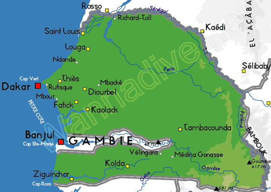
 Senegal
Afryka
Dive sits are mainly around Dakar. There are only two or three dive centers. Don't miss the Gorée area and several far dive sites (shoals).
Fauna is a mix between tropical and temperate water fishes.
Lokalizacja: Western Africa, bordering the North Atlantic Ocean, between Guinea-Bissau and Mauritania.
Koordynaty geograficzne: 14° 0' N, 14° 0' W
Linia brzegowa: 531 km km
Klimat: Tropical; hot, humid; rainy season (May to November) has strong southeast winds; dry season (December to April) dominated by hot, dry, harmattan wind.
Teren: Generally low, rolling, plains rising to foothills in southeast
Najwyższy punkt: Highest point: unnamed feature near Nepen Diakha 581 m
Naturalne zagrożenia: Lowlands seasonally flooded; periodic droughts
Waluta: XOF
Populacja: 10,852,147 (July 2004 est.)
Języki: French (official), Wolof, Pulaar, Jola, Mandinka
Stolica: Dakar
Podział: 11 regions (regions, singular - region); Dakar, Diourbel, Fatick, Kaolack, Kolda, Louga, Matam, Saint-Louis, Tambacounda, Thies, Ziguinchor
Więcej szczegółów
| Jan | Feb | Mar | Apr | May | Jun | Jul | Aug | Sep | Oct | Nov | Dec | |
|---|---|---|---|---|---|---|---|---|---|---|---|---|
| Climate | ||||||||||||
| Air temp. | ||||||||||||
| Water temp. | ||||||||||||
| Equipment | ||||||||||||
| Best season | ||||||||||||
Dodatkowa mapa
Chcesz dodać jakąś informację o Senegal? Znamy....
Ta mapa jest interaktywna! Użyj kontrolek celem przybliżenia i oddalenia.
- dive logs (0)
- podróże (0)
- Zdjecia (1)
- Filmy (0)
- Podziel się
- Ulubione
-
Twoje ulubione i przyszłe miejsca nurkowe
Miejsca nurkowania
| Miejsca nurkowania (3) | Jakość | Średnia głębokość | Maksymalna głębokość | Doświadczenie | Typ nurkowania | ||
|---|---|---|---|---|---|---|---|
| Madeleine islands | - / - | 49.2 ft | 82 ft | Dla każdego nurka | |||
| Séminole bank | - / - | 82 ft | 114.8 ft | CMAS ** / AOW | 
|
||
| Tacoma | - / - | 39.4 ft | 49.2 ft | Dla każdego nurka | 
|
 Komentarze
To będzie pierwszy komentarz o tym kraju
Błąd, powiadom nas o błędzie
Jeśli chcesz dodać nowe informacje lub znalazłeś błędy w opisie tego kraju, Wyślij nam odpowiedź zwrotną.